Account
User Login
shop by category
Menu
Skip to content
About Us
Blog
Cart
Checkout
Compare
Compare
Compare
Compare
Contact Us
Delivery Information
eSmart Special | B2C Products
eSmart Test About Us
eSmart Test Cart
eSmart Test Contact Us
eSmart Test Home
eSmart Test Mobile App Preview
eSmart Test My Account
eSmart Test Search Results
eSmart Test Shop / All Products
eSmart Test Single Product
FAQs Page
Free Website Registration Form
Home
My Account
Newsletter
Online EMI (SSLCOMMERZ)
Privacy Policy
Query Submit
Returns & Refunds
Shop
Super Sale | UpTo 50 % Off
Terms & Conditions
Terms & Conditions
Wholesale
Wishlist
Industrial Supplies
Agriculture Industry
Animal Food
Accessories
Chain & Rope
Furniture & Patriotism
Generator
Machinaries
Medicine
Gardening Machine & Tools
Seed
Trees & Plant
Automobile Industry
First Aid Kit
Aircraft
Accessories
Heavy Equipment
Electric Bicycle & Scooter
Folding Bicycle
Motorcycle
Parts and Accessories
Generator
Pickupp Track
Power Tools
Tyre and Battery
Lubricants
Food Industry
Accessories
Food & Beverage
Furniture
Generator
Interior Design
Machinery and Equipment
Packaging and Printing
Software
Hotel Industry
Home & Kitchen Appliances
First Aid Kit
Accessories
Furniture
Generator
Interior Design
Carrier and Storage
Power Tools
Cleaning Tools
Gardening Machine & Tools
Amenities
Safety and Security
Software
Supplies
Real Estate Industry
First Aid Kit
Elevators & Lifts
Accessories
Chain & Rope
Doors
Gardening Machine & Tools
Generator
Electrical Material
Gardening and Landscaping
Software
Hardware
Interior Design
Machinery and Equipment
Paint
Power Tools
Raw Material
Safetywear
Sanitary Material
Scaffold
Water Pump
Water Tank
Garments Industry
First Aid Kit
Accessories
BASKET
Bucket & Trolley
Chain & Rope
Generator
Gardening Machine & Tools
Hand Tag
Machineries
Power Tools
Safety Equipment
Software
Medical Industry
First Aid Kit
Accessories
Equipment
Furniture
Gardening Machine & Tools
Generator
Interior Design
Supplies
Small Industry
Accessories
Chain & Rope
Equipment
Gardening Machine & Tools
Machinery
Others
IT Industry
Machineries
Networking
Printing & Packaging
Printing
Poster, Banner & Festoon
Brochure
Business Card
Calendar
Challan Book
Diary
Delivery slip
Envelopes
File Printing
Flyers
Invoice
Leaflet
Ledger Khata
Money Receipt
Note Book
Letter Head
PVC
Sticker
TaliKhata
ID Card & Accessories
Poly Bag sealer Machine
Tape Dispenser Gun
Price Tag Machine
Packaging
Courier Bag
Poly Bag
Plastic Bottle
Silica Gel
Scotch Tape
Zip Tie
Zipper Poly
Boxes
Bubble Wrap
Cotton tape
Chain & Rope
Carton
Gift Box
Paper Bag
Printed Box
Take Way Box
Tissue Bag
Power Tools
Impact DRILL
DEWALT
Makita
Ronix
Black & Decker
Impact Driver
Makita
Impact Wrench
Makita
Jig Saw
DEWALT
Black & Decker
Makita
Magnetic Drilling
DEWALT
Makita
Metal Shear
Makita
Multi Tools
Makita
Petrol Chain Saw
Makita
Planers Machine
Black & Decker
DEWALT
Makita
Plate Joiner
Makita
Pneumatic Brad Nailer
Makita
Polisher
Black & Decker
Makita
Ronix
DEWALT
Portable Band Saw
Makita
Recipro Saw
Makita
Rotary Hammer Drill
Makita
Ronix
DEWALT
Black & Decker
Router Machine
Makita
DEWALT
Black & Decker
Sander
DEWALT
Makita
Screwdriver
Makita
Table Saw
Makita
Trimmer Machine
Makita
Aluminium Groove Cutter
Makita
Angle Grinder
Makita
Ronix
DEWALT
Bench Grinder
Makita
DEWALT
Blower
Makita
DEWALT
Black & Decker
Circular Saw
Black & Decker
Makita
Ronix
DEWALT
Compound Mitre Saw
Makita
Cordless Tools
Makita
Ronix
DEWALT
Black & Decker
Cut Off Saw
Makita
DEWALT
Ronix
Cutter
Makita
Demolition Hammer
Makita
DEWALT
Ronix
Die Grinder
Makita
DEWALT
Drill
Makita
Ronix
Electric Chain Saw
Makita
High Pressure Washer
Black & Decker
Makita
Hot Air Gun
Makita
Gifts & Event
Desk Organizer
Ball Pen
Glass Coaster
Slip Pad Holder
Muffler
Badge
Chocolate
Clock
Crest
Diary
Desk Calendar
Flower
Gift Box
Key Ring
Leather Gift
Mug
Note Book
Paper weight
Pen Holder
Phone Case
Mobile Stand
Photo Frame
T-Shirt
Tissue Box
Umbrella
USB Drive
Event Accessories
Paper Cup
150ml
200ml
250ml
Card Holder
Cap
Bag
Food Package of Milad
Kitchen & Cleaning
Adjust Fan
Ashtray
Waste Bin
Cleaning Items
Cleaning Tools
Coffee Maker
Glass Set
Hot Pot
Ladder
Lunch Box
Micro Oven
Tea/Coffee/Milk
One Time Cup Container
Vacuumed Cleaner
Tissue
Water Filter
Portable Weight Machine
Office Decoration
School Furniture
Education Institution
Shoe Box
Table
Executive Desk
Computer
MD
Meeting
Chair
Executive Chair
Restaurant
Visitor Chair
Computer
Guest
Presidential Chair
Work Station
Carpet
Certain
Bulb
Coat Hanger
FAN
File Cabinet
Selves
Sofa
Vacuum Cleaner
Wallpaper
Interior Design
Office Equipment
Laptop
Apple
HP
Dell
Lenovo
Acer
Desktop
Apple
Dell
Asus
HP
I-Life
Monitors
Dell
HP
Samsung
Asus
Mouse & Keyboard
HP
Logitech
PROLiNK
Printer & Scanner
HP
Canon
EVOLIS
Epson
Brother
Mustek
Lexmark
Photocopier
Canon
HP
Ricoh
SHARP
Toshiba
Label/Barcode Printer
Brother
Sewoo
Zebra
Toshiba
Ink, Toner & Drum Unit
HP
Lexmark
Canon
Dell
Epson
Samsung
Xerox
Brother
ID Card Printer
EVOLIS
Zenius
Headsets
Jabra
Prolink
Speaker
Microlab
Logitech
Edifier
Xtreme
Computer Accessories
Apple
HDD
Apacer
Memory Card
Adata
SanDisk
Apacer
Transcend
TV
Samsung
Sony
Microphone
Audio Technica
Boya
Razer
UPS
Kstar
MaxGreen
Modem
Prolink
D-Link
Networking Device
Access Point
Microtik
Mi
Tenda
TP Link
LAN Card
Tenda
TP- Link
Network Switch
Tenda
TP Link
Cisco
Mikrotik
Router
TP Link
PROLiNK
Mikrotik
Cisco
Mi
Tenda
Projector
Asus
Benq
Dell
Toshiba
USB Drive
SanDisk
ADATA
Kingston
Apacer
Transcend
Web Camera
Logitech
POS & Barcode Reader
POS Printer
Thermal Paper
Bar Code Reader/Scanner
Attendance Machine (RF ID)
JunRong
CP Plus
ZKTeco
Processor
Intel
Cash Drawer
MAKEN
Stabilizer
Water Heater
Coffee Maker
Conference Systems
Micro Oven
IP Telephone/Corporate
AC
Calling Bell
ECR
Fridge
IPS(Battery)
Money Counter
Multiplug
Phone
Shredder
Tele Phone
USB Hub
Vacuum Cleaner
Weight Measure machine
Security & Safety
First Aid Kit
Road Safety
Safety Wear
Foot Protection
Hand Protection
Head Protection
2A Radio
Bag Scan
Access Control
ZKTeco
Security Camera
Finger Print Lock
Fire Alarm/Safety Alarm.
Fire Extinguisher
Metal Door
Rf lock
Safe Locker
Security lock
Stationary
Envelope
Fluid
Ball Pen
Packaging
Paper Trimmer
Register Khata
Stamp Pad Ink
Calculator
Casio
Citizen
Deli
Card Holder
Clip
Clip Board
File & Folder
Glue
Glue Tape
Marker
Paper
Dot Printing
Legal Paper
Paper (A4 Size)
Slip Paper
Sticker Paper
Paper Weight
Black & Decker
Pen Holder
Pen Holder & Organizer
Punching Machine
Erasers & Corrections
Scale
Scissor & NT Cutter
Stamp & Stamp Pad
Staplers & Remover
e-Services
AC repair
Legal Documentation
Catering
Computer Repair
Interior Design
Lunch
Networking
Office Cleaning
Office Movers
Paint
Software
E-Commerce Web Site
Hospital
Inventory Management
POS
Restaurant
Super Shop
Tracking Software
Attendance Software
Machinery
Covid-19
Home
/
Industrial Supplies
/
Real Estate Industry
/
Survey Instruments
Survey Instruments
Showing 1–24 of 59 results
Sorted by popularity
Sort by popularity
Sort by average rating
Sort by latest
Sort by price: low to high
Sort by price: high to low
3D Scanner
(2)
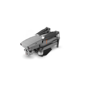
Drone
(17)
Fluke
(4)
GPS
(5)
RTK GPS
(9)
Surveying Accessories
(7)
DJI Phantom 4 Multispectral Drone
Read more
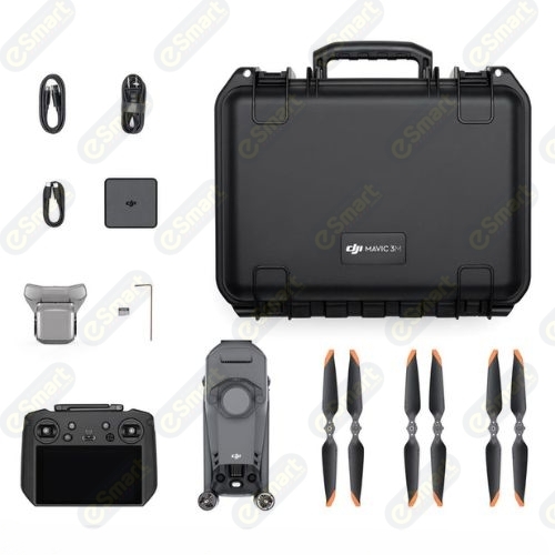
DJI Mavic 3M Drone
Read more
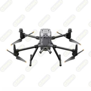
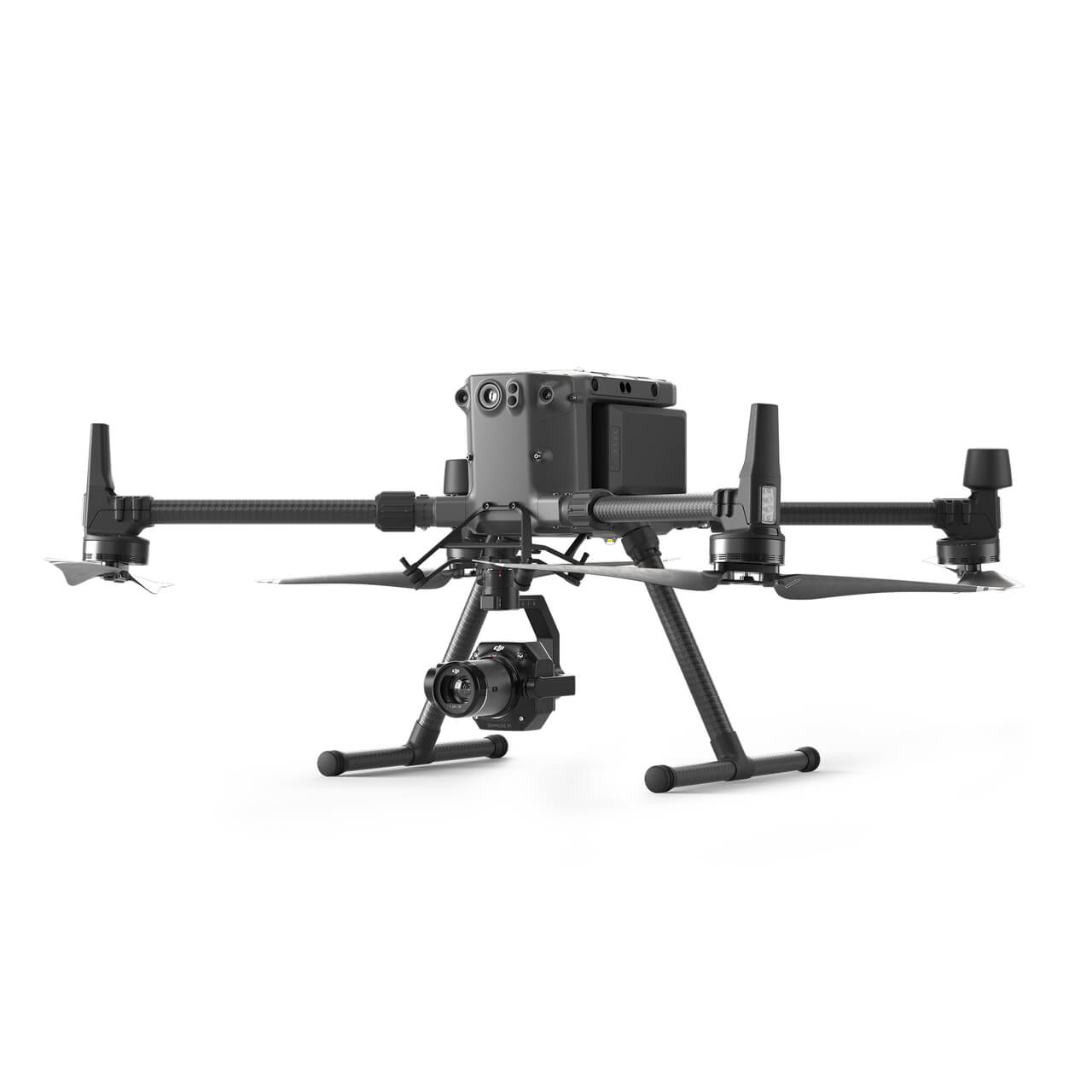
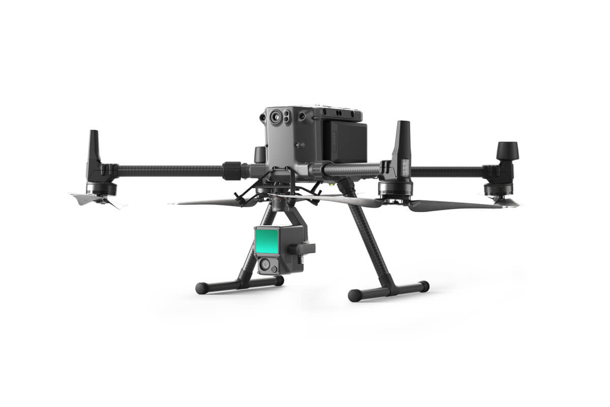
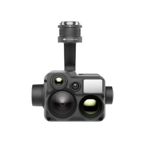
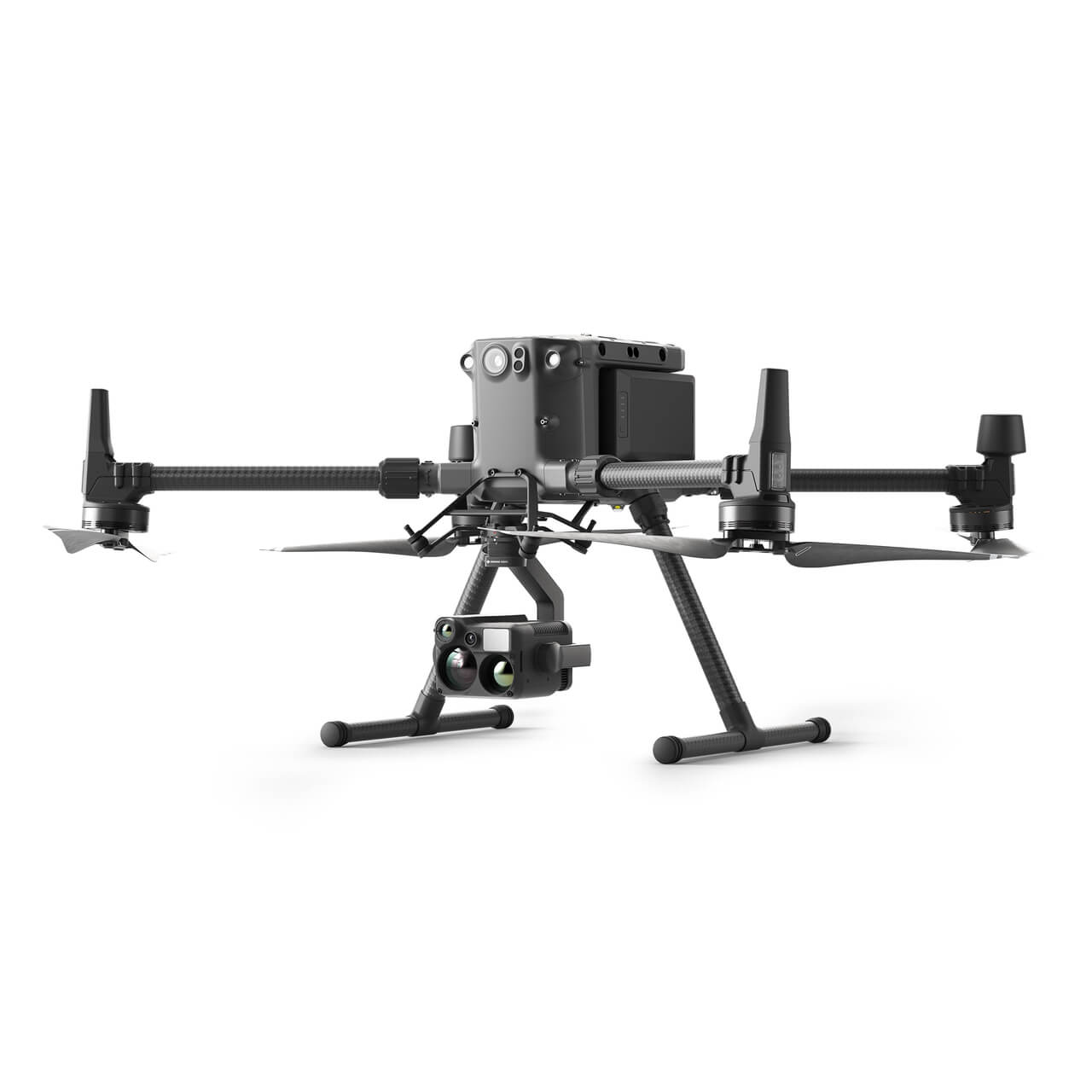
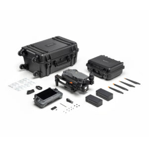
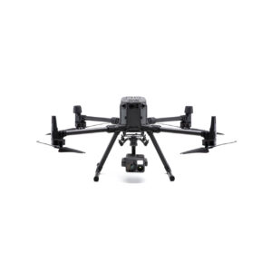
DJI Matrice 30 Series Drone
Read more
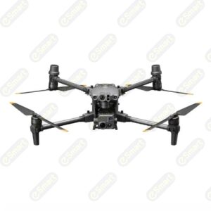
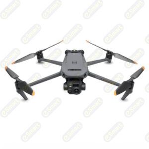
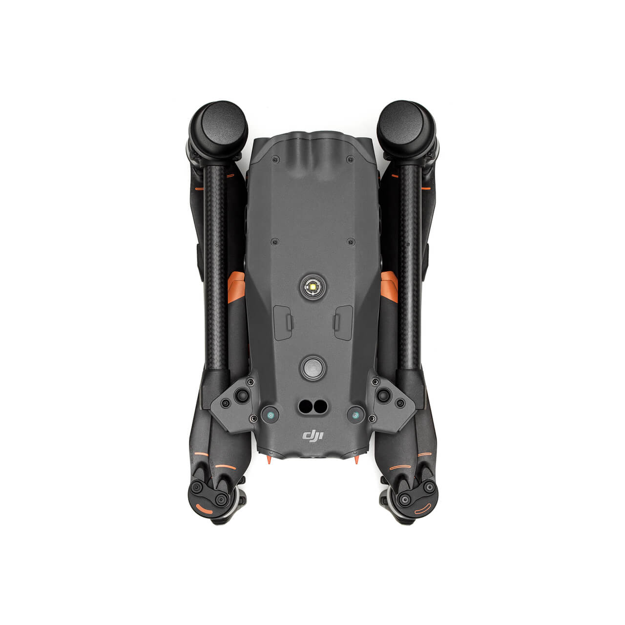
DJI Mavic 3 Enterprise: Mavic 3E & Mavic 3T
Read more
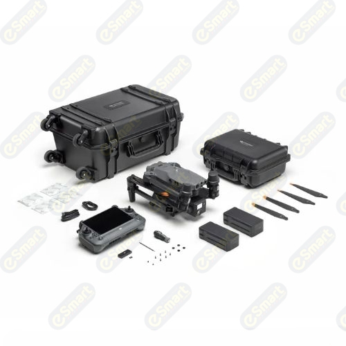
DJI Matrice 350 RTK Drone
Read more
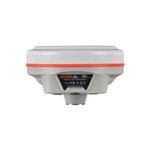
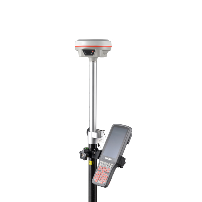
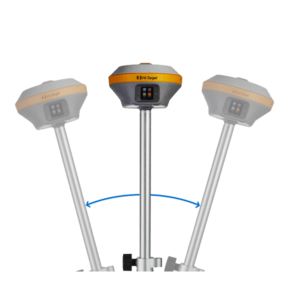
Kolida K9x RTK GNSS System
Read more
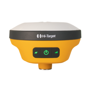
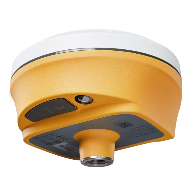
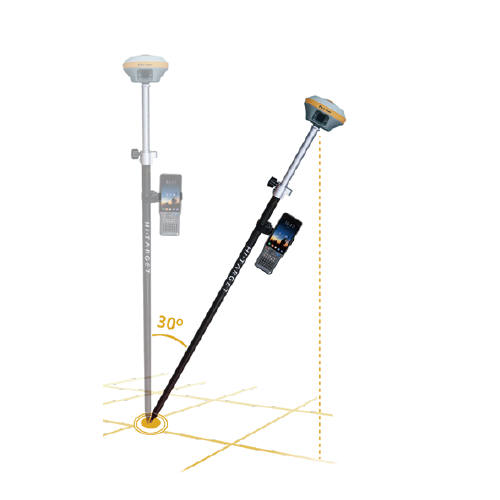
Hi-Target V200 GNSS RTK System
Read more
Hi-Target V500 GNSS RTK System
Read more
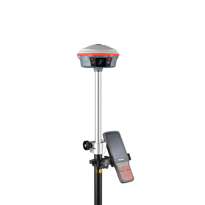
Kolida K30 RTK GNSS Survey Instrument
Read more
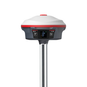
Hi-Target iRTK5 GNSS RTK
Read more
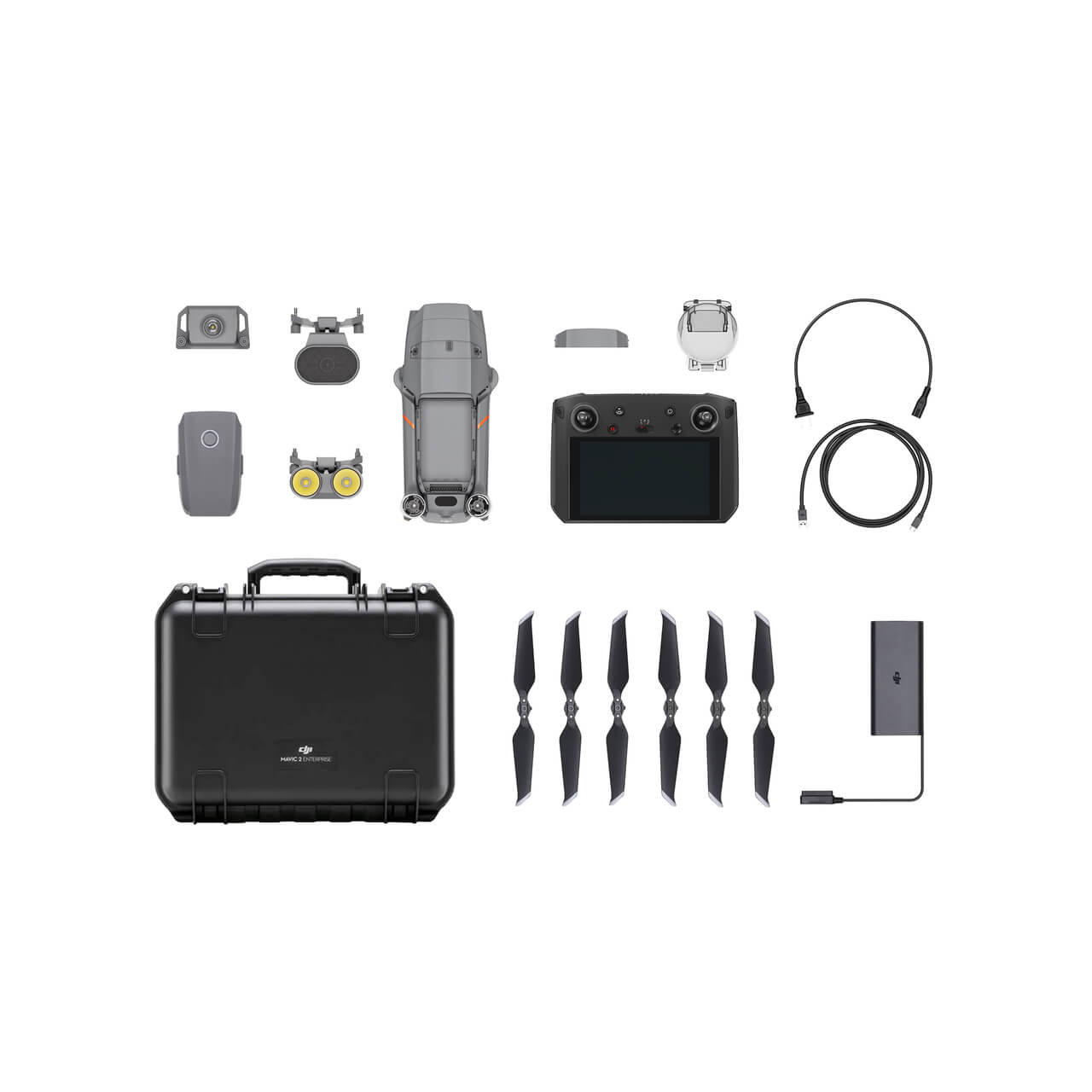
Mavic 2 Enterprise Advanced
Read more
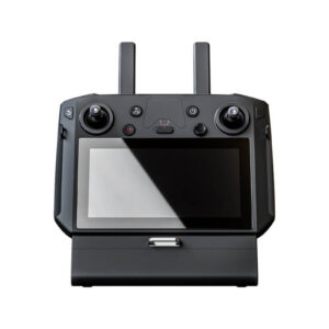
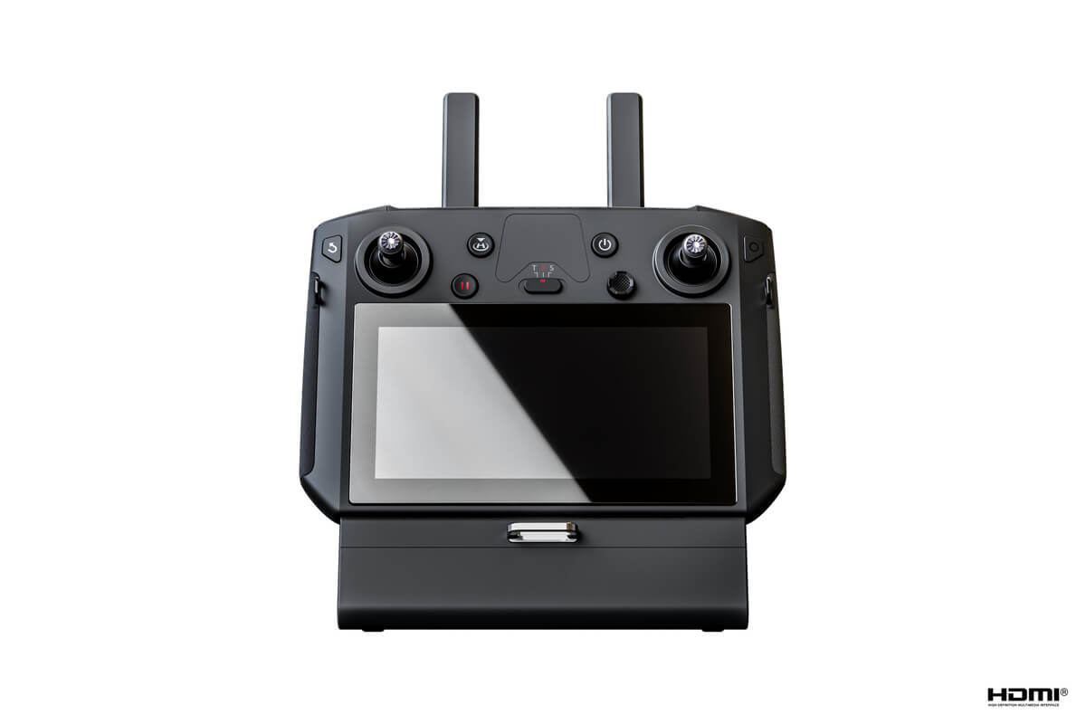
Matrice 300 Series DJI Smart Controller Enterprise
Read more
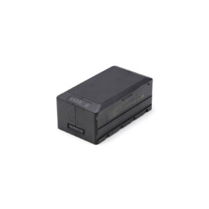
Matrice 300 Series TB60 Intelligent Flight Battery
Read more
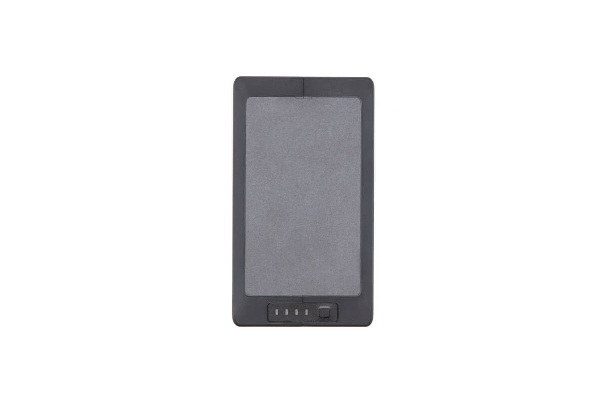
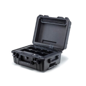
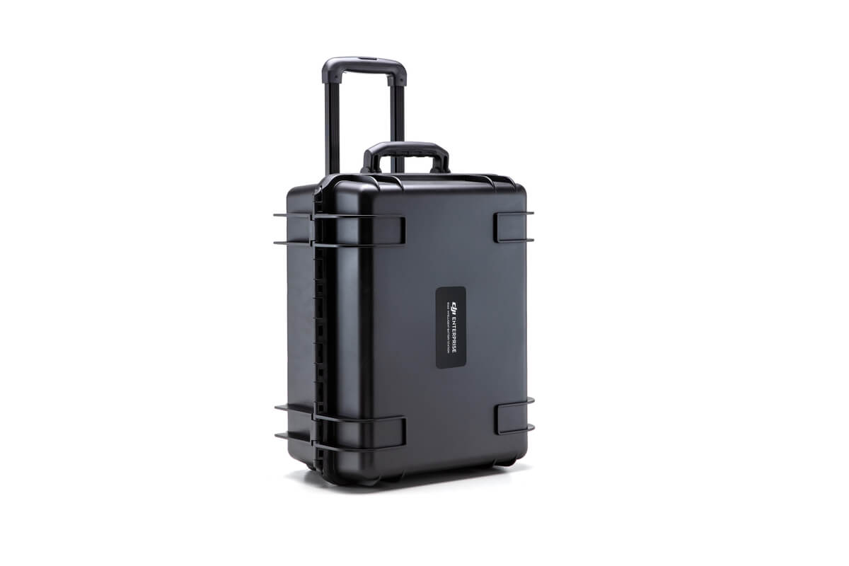
Matrice 300 Series BS60 Intelligent Battery Station
Read more
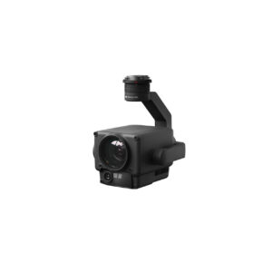
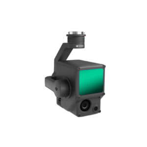
Zenmuse H20
Read more
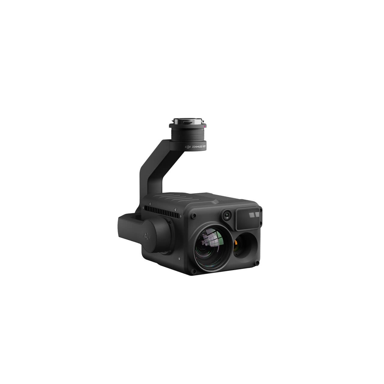
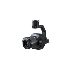
Zenmuse H20T
Read more
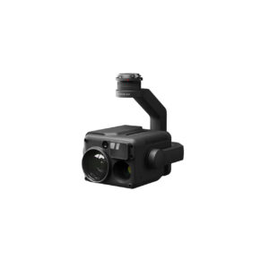
Zenmuse P1
Read more
Zenmuse L1
Read more
Zenmuse H20N Worry-Free Plus Combo
Read more
Matrice 30T Worry-Free Plus Combo
Read more
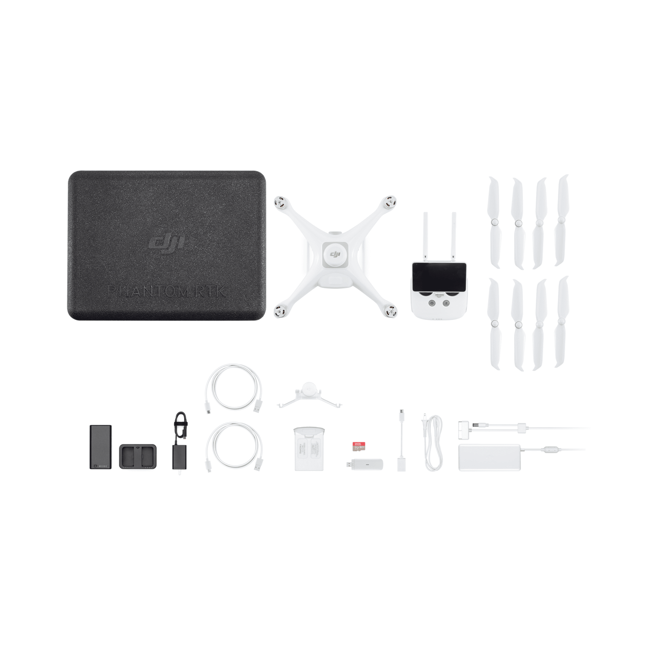
Phantom 4 RTK SE
Read more
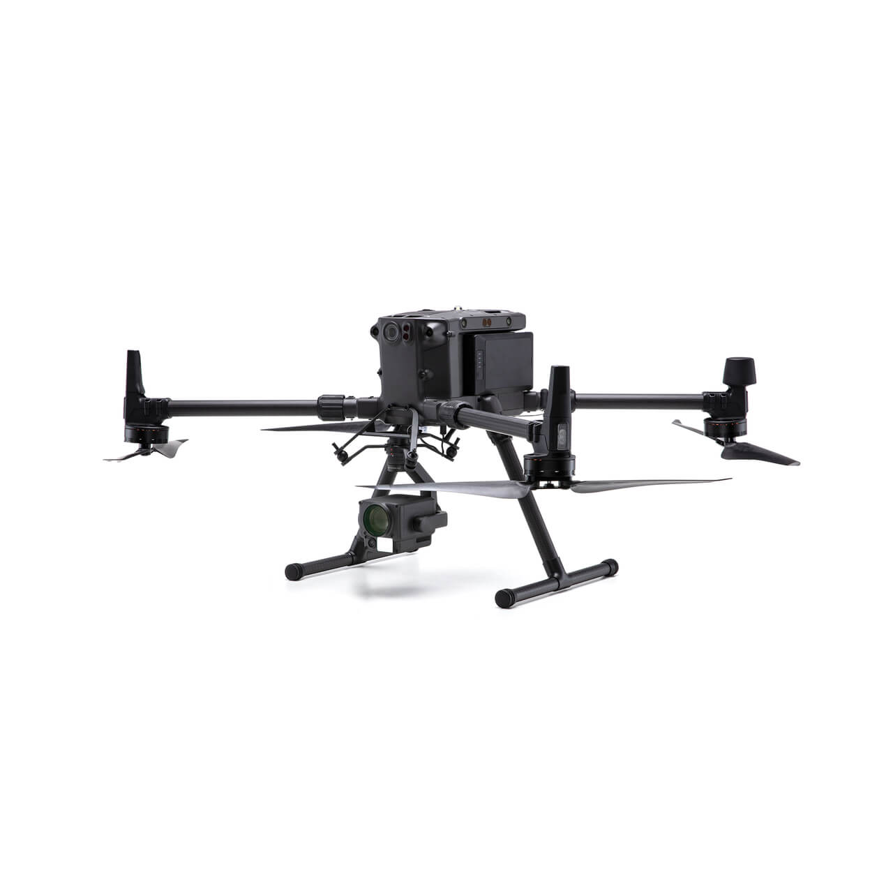
MATRICE 300 RTK
Read more
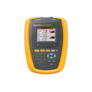
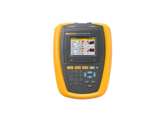
Fluke 830 Laser Alignment Tool
Read more
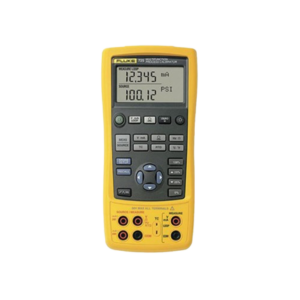
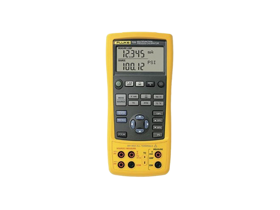
Fluke 725 Multifunction Process Calibrator
Read more
1
2
3
→
escort mersin