


Description
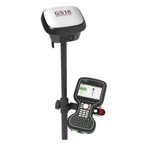
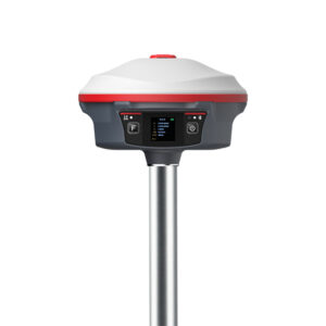
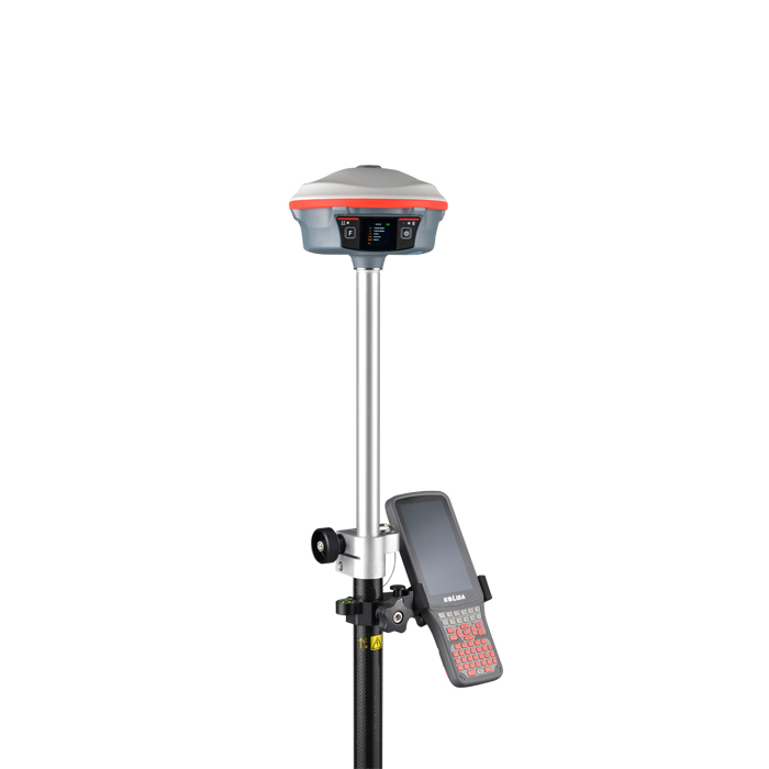
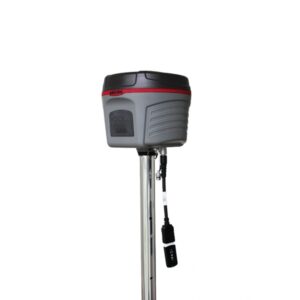
iRTK5 GNSS RTK System: High-Accuracy Positioning for Professionals
The iRTK5 GNSS RTK System is a high-accuracy positioning system that utilizes real-time kinematic (RTK) technology to deliver centimeter-level accuracy for a wide range of applications. Ideal for surveyors, engineers, and GIS professionals, the iRTK5 GNSS RTK System provides reliable and efficient data collection for tasks such as:
- Land Surveying
- Construction Stakeout
- GIS data collection
- Precision Agriculture
Key Features of the iRTK5 GNSS RTK System:
- Centimeter-level accuracy: The iRTK5 GNSS RTK System delivers precise positioning data, ensuring reliable results for your projects.
- Rugged and durable design: Built to withstand tough conditions, the iRTK5 GNSS RTK System is ready for any job site.
- Easy to use: With a user-friendly interface and intuitive operation, the iRTK5 GNSS RTK System is ideal for both experienced professionals and new users.
- Long battery life: Power through your workday with the iRTK5 GNSS RTK System’s long-lasting battery.
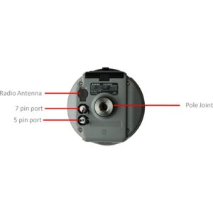
iHand55
- Android 10
- Type C USB port
- 2G RAM, 16G Internal Storage
- WiFi & Cellular simultaneous working
- IP 68

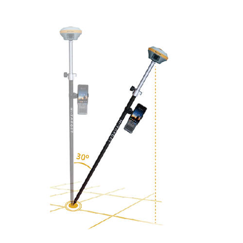
Revolutionize your surveying workflow with the iRTK5’s built-in IMU, enabling calibration-free tilt surveys. This innovative technology eliminates the need for bubble leveling, saving you time and effort on the job. Simply reach your survey point and start collecting data – it’s that easy. Whether you’re a surveyor, engineer, or construction professional, the iRTK5 GNSS RTK System is the perfect tool for all your high-precision surveying needs.


Reviews
There are no reviews yet.